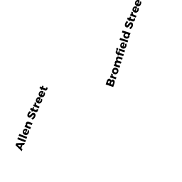
10 BROMFIELD CT
Owner Information
NELSON JAMES B
10 BROMFIELD CT
NEWBURYPORT, MA 01950


Property Details
10 BROMFIELD CT is classified as a Single Family Residential (Conventional).
The primary structure on this property was built in 1889. There are 2,654ft2 of built area within this property. There is 1,278ft2 of residential/living space within this property. This property is listed as having 50 rooms.
10 BROMFIELD CT is valued at $433,900. The land is valued at $240,000 and the structures are valued at $193,900.
This property is in Zone R3. Confirm with local Zoning Board authorities to ensure there are no overlays or other easements on this property.
The most recent deed for 10 BROMFIELD CT is recorded at the local registrar in Book 15405, Page 422. 10 BROMFIELD CT was last sold on Friday, January 15, 1999 for $200,000.
Assessment data from fiscal year 2021.
Flood Data
According to the FEMA National Flood Hazard Layer, this property does not appear to be in a flood zone. It may also be in an area not yet reviewed. Nonetheless, confirm this information prior to taking any action.
To view the flood hazards around this property, create a FEMA "Firmette" Map of the area around 10 BROMFIELD CT.
Broadband Internet Providers
| Provider | Type | Bandwidth (mbps) | |
|---|---|---|---|
| Viasat Inc | Satellite | 100 | 3 |
| Verizon New England Inc. | DSL | 15 | 1 |
| Comcast | Cable | 1000 | 35 |
| T-Mobile | Fixed Wireless | 25 | 3 |
| GCI Communication Corp. | Satellite | 0 | 0 |
| HughesNet | Satellite | 25 | 3 |
| VSAT Systems, LLC. | Satellite | 2 | 1 |
Broadband service provider data from December 2020.
Adjacent Properties
- 8 BROMFIELD CT
Single Family Residential owned by DARCY MICHAEL B TRUSTEE - HIGH-CHESTNUT ST LOT
Electric Transmission Right-of-Way owned by MASSACHUSETTS ELECTRIC CO - 73 BROMFIELD ST
Single Family Residential owned by BASHORE SCOTT C - HIGH-CHESTNUT ST LOT
Electric Transmission Right-of-Way owned by MASSACHUSETTS ELECTRIC CO